Our daily weather—warm, sunny, windy, cold, rainy, snowy—is dependent on many factors in the earth’s atmosphere. The atmosphere surrounds Earth, going up for more than 300 miles until it blends in with space. This protective atmosphere has five layers, including the stratosphere, which uses ozone to absorb ultraviolet radiation from the sun before it reaches Earth. The layer closest to Earth is called the troposphere and contains 80% of the gases (such as nitrogen and oxygen) that are in the atmosphere. It also contains water vapor, or water in its gas state (like steam), which can form clouds. The temperature in the troposphere decreases with height, so weather at the top of this layer will be much colder.
Weather can change rapidly just from day to day, but we usually notice the biggest changes with each season. Did you realize that in winter, the sunlight reaching Earth is weaker than in summer? This is because the light is less direct: it reaches the earth at an angle. You can demonstrate this with a ball and a flashlight to represent the earth and sun. Hold the flashlight so its beam shines straight down on the ball. Note what the spot of light looks like on the ‘earth.’ Now, bring the light down so that it hits the ball at an angle. What does the light spot look like now? The area of the spot expands, but the light is not as strong as it was with the more direct beam. The difference between winter and summer light is caused in the same way, by the angle of the sun and earth. In addition, the days are shorter in winter, allowing less time for sunlight to heat up the earth, whereas the long summer days allow much more heat to penetrate.
Climate is based on the average weather in an area over a long period of time, and therefore is fairly unchanging—unlike the daily weather. The main types of climate are polar, desert, tundra, tropical, equatorial, Mediterranean, temperate, and continental. Tropical regions are warm year-round and have a wet and dry season; equatorial regions are always warm and moist, providing ideal rainforest conditions. Temperate regions are generally cool year-round; continental regions are hot in summer and cold in winter. Both of these climates can be found in the northern regions of the Unites States. Polar climates are so cold and dry that little plant life can grow there; plants in the desert, however, are specially designed to store water so that they can survive off of little rainfall. Tundra regions have strong winds and low winter temperatures. The weather in Mediterranean climates is influenced by coastal winds, providing sunny and wet winters and dry summers, ideal for growing citrus fruits. To help your young kids picture different climates, look in magazines like National Geographic for examples of each one. You might also talk about the climates of some different countries and what effect they have on the people living there.
High and low pressure systems play a key role in how our daily weather changes. ‘Highs,’ which usually bring fair weather, develop in areas where air cools and sinks. ‘Lows,’ which indicate stormy weather, form when two different high-pressure air masses meet at a front. Huge sections of air over either land or water can become uniform in humidity (the amount of water vapor in the air) and temperature, forming an air mass. These are either hot or cold and as they meet an opposite air mass, they form a front. Air masses with different temperature and humidity levels mix about as well as oil and water; rather than blending, they push against each other.
A cold front occurs when a faster-moving cold air mass forms a wedge that drives under a warm air mass. It can cause weather changes like thunderstorms and even tornadoes. A warm front happens when a warm air mass moves up at a gradual slope over a cold air mass, usually resulting in less drastic weather change. A stationary front occurs when warm and cold air masses meet and neither is able to push its way through; this ‘stand off’ could last for days. Some precipitation usually results from this kind of front. An occluded front happens when a warm front is overtaken by a cold front and one or the other gets lifted up. This usually brings on stratus clouds (fog-like) and some precipitation, but not necessarily bad weather.
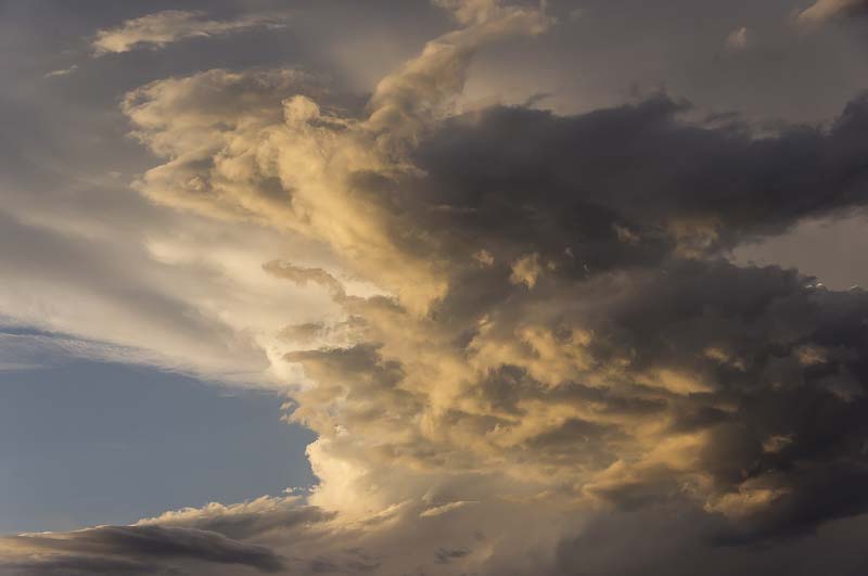
Clouds form when moisture in the air (water vapor, i.e. water in its gas form) condenses. You can demonstrate this by filling a clear container 1/3 full of hot water. Set a baking pan covered with ice over the top of the container. The warm, moist air above the water rises, and then cools as it nears the ice, condensing to form a cloud of water droplets. Clouds in the sky form in the same way: the water vapor in warm air rises and then condenses as it reaches cooler temperatures. The highest clouds, in the coldest parts of the troposphere, are formed by ice crystals rather than condensed water droplets.
When a cloud reaches saturation point—100% humidity—the water vapor begins to condense to a point where the water droplets are so large and heavy that they must fall, due to the pull of gravity. This causes precipitation, which can reach the earth in the form of rain drops, snowflakes (made up of ice crystals), or even hail stones.
Besides bringing precipitation, clouds also influence our weather by keeping the earth cool. On nights when there is a thick cloud cover, the earth does not lose its heat from the sun as fast, thus keeping the night warmer. On clear nights, though, the heat rises up into the atmosphere, cooling the earth.
For an overview of cloud types, see our Clouds, Precipitation, and Weather Forecasting Science Lesson.
Science Lesson: Storms
We’ve all experienced thunderstorms at one time for another. Although some parts of the U.S. average 10 or less a year, a few areas have 100 or more to make up for it! Meteorologists, scientists who study the weather, think that Kampala, Uganda (in East Africa), probably holds the world record for annual thunderstorms: at least 242 occurred in just one year! Although we already know what a thunderstorm is like, here’s how it actually works.
The first thing to note is that warm air rises. Thunderstorms form either when a cold front pushes a warm mass of air up, or when a warm surface temperature (from a hot summer day, for example) heats the air above it. This causes an updraft and the warm air, which holds moisture, forms a cloud as it reaches cooler temperatures. This is called the cumulus stage. The cloud continues to grow, reaching a mature stage. Cold air enters the cloud from the sides and causes a downdraft, although the updraft continues. Ice crystals form at the top and start falling downward through the cloud. Precipitation starts, with rain or even hail, and thunder and lightning. Usually after 30 minutes, the final or dissipating stage begins, with the cold downdrafts pulling the storm apart. There is lighter precipitation as the storm breaks up, usually ending after just an hour.
Lightening
Lightning occurs because of electrical charges, usually the attraction of positive and negative charges between the thundercloud and the ground. However, lightning can occur within a cloud or even run from the ground up to the cloud. Thunder is the result of the lightning super-heating the molecules in the air, causing shock wave vibrations that are the sound waves we hear. Even though the sound waves begin with the lightning, it takes longer for sound to travel than for light and so we hear a clap of thunder after we’ve seen the lightning bolt.
Tornadoes
Tornadoes are closely associated with thunderstorms. A tornado forms within a thundercloud, where winds whirling in opposite directions cause a long funnel cloud to drop out of the main cloud. If the funnel cloud touches the ground, then it’s classified as a tornado. The violent updraft in the middle of the tornado can cause severe damage, since in the biggest tornadoes (as much as 2000 feet across), it is strong enough to rip up houses. Thankfully, almost 70% of tornadoes are weak ones that do little harm.
Hurricanes
Hurricanes form near the equator, in the intertropical convergence zone (ITCZ) where contrasting winds meet. A combination of heat and moisture is necessary for the storm to get started: as the winds swirl around they cause moisture to condense in the air. As this happens, heat increases and gradually a cyclone forms over the water. With hurricanes, there is an endless supply of water while they are over the ocean, so they can grow continuously.
From the first stage, called a tropical depression, the storm can develop into a tropical storm, and then, when winds reach 74 mph or more, it becomes a hurricane. Hurricanes, in spite of their devastating nature, are very orderly storms. They have a calm spot, the eye, in the center (usually about 15 miles wide), surrounded by the strongest winds and dark nimbostratus storm clouds just outside it and then spiral rain bands of precipitation and clouds moving outward from that. In the Northern Hemisphere (the top half of the world), hurricane winds move counter-clockwise, but in the Southern Hemisphere they move in the opposite direction.
As a hurricane approaches land, barometric pressure drops, causing the sea level to rise: in the vacuum brought about by the lowered pressure, seawater rushes up onto the land, causing flooding along with the destruction from the storm. The lowest barometric pressures ever recorded have occurred within hurricanes.
The Saffir-Simpson scale is used to measure the force of hurricanes: 1 is the least destructive (with winds from 74-95 mph) and 5 is the most destructive (wind speeds over 155 mph).